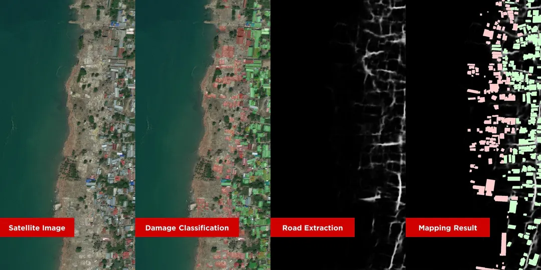
From many disasters in Indonesia, the problem that often occurs in the disaster mitigation process is the difficulty of determining the areas and buildings affected by the disaster and determining the logistics distribution channels needed after a disaster occurs. Manual monitoring can be done, but it will require more resources, such as human and financial resources.
Disaster mitigation follows the processes included in the standard operating procedures according to the level of disaster. MADANI (Mapping and Data Assesment for Natural Incident) is intended to support one of these processes, mainly in estimating areas and buildings affected by disasters and determining post-disaster logistics distribution channels.
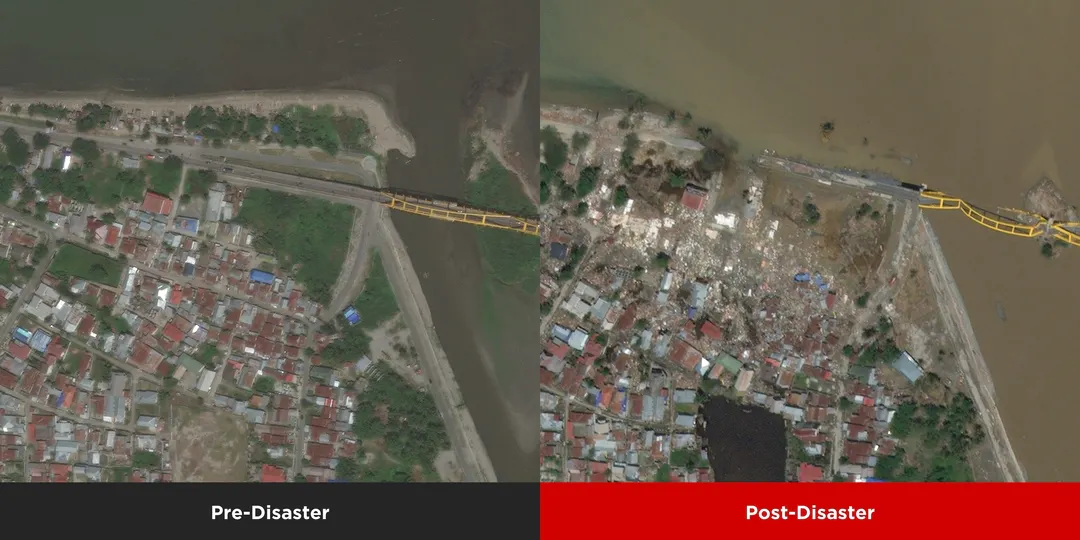
I use the xBD dataset to assess building damage from satellite imagery. xBD provides pre and post-event satellite imagery from various disaster events with building polygons, classification labels for damage types, labels of damage level, and corresponding satellite medatada. Detailed information can be found on the xView2 site. I use the Palu 2018 tsunami disaster satellite data provided by xBD, which can be downloaded here. This dataset contains 226 pre and post-disaster satellite imagery, with 16,764 building polygons.

Streamlit Live Demo
© Azka Radinka. 2023